1 6 marks
Figure 14 and Figure 15 show information about an ash cloud following the eruption of an Icelandic volcano in 2010.
Figure 14
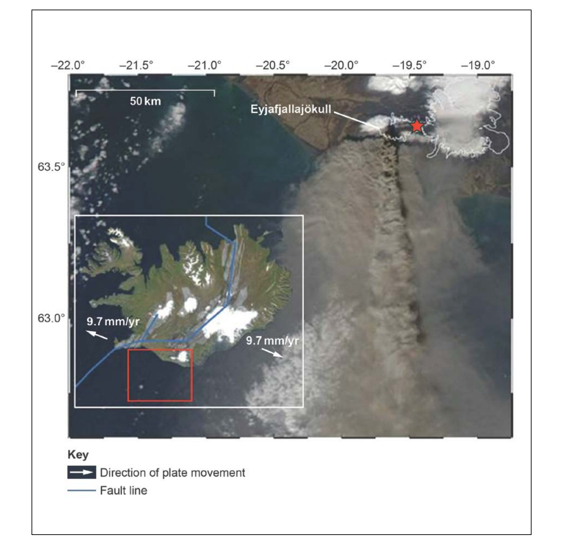
Figure 15

Using Figure 14 and Figure 15, assess the scale of the eruption.
[6]
Did this page help you?
Did this page help you?
[1}
Volcanoes can be monitored by considering the seismic activity and the amount of gases being released. Infrared cameras can also be used to detect magma movement.
A logarithmic scale where the energy release is proportional to the scale of the event. Each unit of increase on the scale equates to approximately 30 times the increase in energy, mainly felt through vibration.
A qualitative scale which measures the impact of the event. The scale has 12 points. At each point there is a description which increases in severity through to total destruction.
A logarithmic scale which offers an indication of the explosiveness of events. It is a way of classifying events by volume of material produced and frequency of events.
Did this page help you?
Figure 9a shows data related to the eruption of Kīlauea Volcano, Hawai’i, USA, on 24 May 2018.
Figure 9b shows a satellite image of the same eruption.
Figure 9a
Data related to the eruption Kīlauea Volcano, 24 May 2018
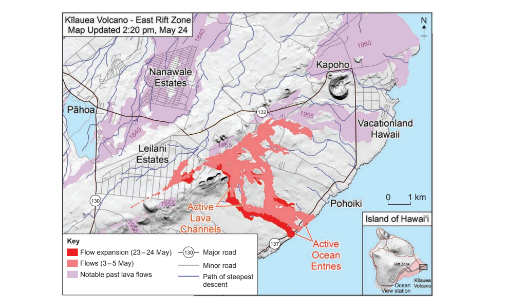
Figure 9b
Satellite image of the eruption of Kīlauea Volcano, 24 May 2018

Did this page help you?
The nuée ardente can be sprayed with sea water. This dramatically reduces the temperature of the gases contained within the cloud, leading to significantly reduced risk.
Lahars can be controlled by geological surveys and drilling to stabilise hillslopes in affected areas. This reduces the likelihood of rockfall.
In certain types of eruptions, lava can be safely channelled away from places of high risk. This can be achieved using explosives and artificially dug channels.
Liquefaction can be managed by geological surveys which can be used to create hazard maps. These maps can then be used by planners to create exclusion zones.
Did this page help you?
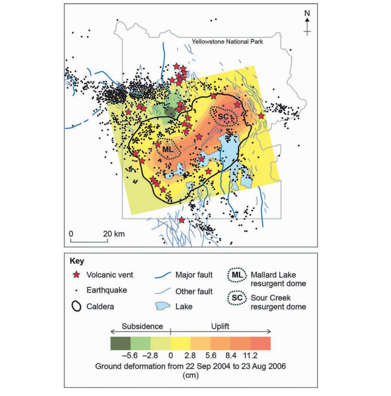
Figure 9, on the insert, shows data related to seismic activity and vertical motion in the Yellowstone caldera in the USA. Sour Creek (SC) is a resurgent dome in the Yellowstone caldera in the USA. A resurgent dome is formed by swelling or rising of a caldera floor due to movement in the magma chamber beneath it.
Figure 10, on the insert, shows a map of Yellowstone: volcanic vents active since the last caldera collapse 640 000 years ago; earthquakes recorded between 2003 and 2008; faults; and ground deformation between 2004–2006.

Did this page help you?
Did this page help you?