Impacts of Tectonic Hazards (Edexcel GCSE Geography: B (1GB0))

Revision Note

Test Yourself
Bridgette

Author

Bridgette

Expertise

Geography Lead

Case Study: La Palma & Indonesia

  • Volcanic eruptions have both primary and secondary effects
Primary effects Secondary effects

Lava 

Deaths and injuries

Water/gas/electricity supplies cut

Transport routes destroyed/damaged

Ash fall

Pyroclastic flow

Landslides

Lahars (mudflow)

Flooding

Tsunamis from landslides

Fires due to broken gas/electricity

Lack of clean water leads to disease

Increases in food prices

  • The impact of these depends on a number of factors including:
    • Magnitude of the eruption
    • Location of the eruption
    • Type of eruption
    • Preparation and planning
    • Monitoring and warning
  • In developing countries the impacts may be greater due to:
    • Lack of monitoring
    • Less preparation and planning
    • Less warning of impending eruption
    • Lack of economic wealth to pay for technology

Developing - Mount Merapi, Indonesia

  • Merapi is a composite volcano with andesitic magma
    • The magma is very thick/viscous and often blocks vents causing pressure to build
    • Leads to explosive eruptions
  • It is located on the island of Java on the subduction zone of the Indo-Australian and Eurasian plates
  • Three eruptions between 25-26th October 2010 followed by further eruptions until November
  • The eruptions were 4 on the Volcanic Explosivity Index (VEI)

location-of-mount-merapi

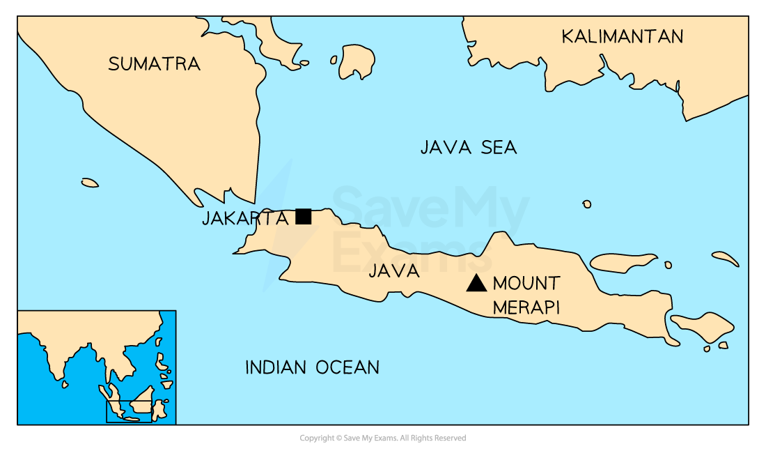
Location of Mount Merapi

Primary impacts

  • Ash reached altitudes of 18km
  • Ash fell up to 30km from the volcano damaging 200 hectares of forest and large areas of crops
  • Pyroclastic flow spread 3km 
  • A sulphur dioxide cloud formed over Indonesia and the Indian Ocean
  • 353 people were killed

 Secondary impacts

  • The exclusion zone had to be extended
  • Food prices increased due to the destruction of crops and livestock
  • Over 300,000 people were displaced
  • The airports were closed to flights due to the ash - 2500 flights were cancelled
  • People suffered respiratory infections, skin and eye irritations and headaches from the ash and sulphur dioxide
  • Tourism fell by 30% (domestic tourists) and 70% (international tourists)

Developed - La Palma

  • Part of the Canary Islands, La Palma is located in the Atlantic Ocean off the coast of North Africa
  • The Canary Islands are an [popover id="RAr2r~3MbVY7biGB" label=''autonomous region"] of Spain
  • There are 33 volcanoes across the Canary Islands, 10 of which are in La Palma
  • The Cumbre Viejo volcano on La Palma began to erupt on the 19th September 2021 and the eruption lasted for almost three months
  • The eruption was VEI 2 to VEI 3
  • La Palma and the other Canary Islands are located on the African plate
  • The islands are an archipelago which has formed as the result of a hot spot
  • This means that they are not located on a plate boundary but over a magma plume
  • A cinder cone volcano with basaltic lava

location-of-la-palma-volcanic-eruption-1

Location of Cumbre Vieja Volcano

Primary impacts

  • Almost 1,500 houses were destroyed by the lava flow
  • Over 1,500 other buildings such as churches, shops, schools were destroyed
  • The lava flow cut across the coastal highway and covered 1000 hectares
  • Water supply was cut off for almost 3,000 people
  • 400 hectares of banana farms were destroyed
  • Almost 1,300 hectares of land was effected
  • 1 death

Secondary impacts

  • Air traffic was suspended on a number of occasions due to ash in the atmosphere
  • Over 1000 people were evacuated after the eruption began on the 19th September
  • A further 5600 people were evacuated over the next few weeks
  • About 20,000 people were exposed to the eruption and its effects

Case Study: Italy & Nepal

  • Earthquakes have both primary and secondary effects
Primary effects Secondary effects

Shaking of the ground

Deaths and injuries

Destruction and damage of buildings

Destruction and damage of infrastructure

Flooding

Tsunamis 

Fires due to broken gas/electricity

Lack of clean water leads to disease

Landslides

Homelessness

  • The impact of these depends on a number of factors including:
    • Magnitude of the earthquake
    • Location of the epicentre
    • Population density
    • Preparation and planning
    • Monitoring and warning
  • In developing countries the impacts may be greater due to:
    • Lack of monitoring
    • Less preparation and planning
    • Poor building quality 
    • Poor infrastructure
    • Lack of economic funds for technology

Developing - Nepal

  • Nepal is one of the poorest countries in the world with a Gross Domestic Product (GDP) of under $1000 
  • Located between China and India, Nepal is a landlocked country
  • In 2015 80% of the population lived in rural, often remote, communities
  • In April 2015 at 11.26 am Nepal was struck by an earthquake, magnitude 7.8
  • The epicentre was 80 km northwest of Kathmandu in the Gorka district
  • The focus was shallow at only 15 km beneath the surface
  • Over 300 aftershocks followed the main earthquake

location-of-nepal-earthquake

Primary impacts

  • Approximately 9000 deaths 
  • Over 20,000 people injured
  • Electricity and water supplies cut
  • 7000 schools and 1000 health facilities were damaged or destroyed
  • UNESCO world heritage sites destroyed as well as many temples

Secondary impacts

  • Almost 3.5 million people were made homeless
  • Offices, shops and factories were destroyed meaning people were unable to make a living
  • Loss of tourist income which Nepal is reliant on
  • Damages estimated at between $7 and $10 billion about 35% of the GDP
  • Spread of disease due to lack of clean water
  • Landslides which blocked roads and rivers
  • Avalanches on Mount Everest and in the Langtang Valley

Developed - Italy

  • Italy is a High-Income Country (HIC) with a GDP per capita of over $31,000
  • It is located in Europe 
  • On 24 August 2016 central Italy was struck by a magnitude 6.2 earthquake
  • The epicentre was 100 miles to the north-east of Rome
  • The focus was shallow at only 5.1km
  • Over 200 aftershocks followed the main earthquake over the next couple of days
  • Italy is located along the plate boundary where the Africa plate meets the Eurasian plate
  • The two fault lines running through Italy are the North-South Fault and the East-West Fault

strength-of-earthquake-tremors

Strength of the Italian earthquake tremors

Primary impacts

  • Severe damage to buildings
    • 80% of buildings in Amatrice old town were affected
    • Over 50% of all buildings in Amatrice were damaged and destroyed
    • The school in Amatrice collapsed
  • 296 people died
  • 400 people were injured
  • Farmers were affected as 90% of barns and stalls for livestock in the immediate area were destroyed
  • Amatrice hospital was badly damaged

Secondary impacts

  • Landslides blocked the roads 
  • Psychological effects on the population
  • Tourism was negatively affected
  • 4454 people were made homeless

Worked example

Identify one primary impact of tectonic hazards

(1 mark)

  A   loss of employment
  B.  spread of disease
  C.  destruction of buildings
  D.  homelessness

Answer:

  • C - destruction of buildings (1)

You've read 0 of your 0 free revision notes

Get unlimited access

to absolutely everything:

  • Downloadable PDFs
  • Unlimited Revision Notes
  • Topic Questions
  • Past Papers
  • Model Answers
  • Videos (Maths and Science)

Join the 100,000+ Students that ❤️ Save My Exams

the (exam) results speak for themselves:

Did this page help you?

Bridgette

Author: Bridgette

After graduating with a degree in Geography, Bridgette completed a PGCE over 25 years ago. She later gained an MA Learning, Technology and Education from the University of Nottingham focussing on online learning. At a time when the study of geography has never been more important, Bridgette is passionate about creating content which supports students in achieving their potential in geography and builds their confidence.