River Practical Skills (Edexcel IGCSE Geography)

Revision Note

Test Yourself
Bridgette

Author

Bridgette

Expertise

Geography Lead

River Practical Skills

River Fieldwork Enquiry

  • To undertake a river fieldwork enquiry there are a range of practical skills and methods that will be used
  • These can be applied to any river fieldwork
  • The fieldwork enquiry should be linked to geographical theory
    • In the river fieldwork enquiry the Bradshaw model is usually used

bradshaws-model

The Bradshaw Model

Aims and Hypothesis

  • The aims and hypothesis come from questions asked about the river such as:
    • Does discharge increase along the length of River Y?
    • Does the average velocity increase along the length of River Y?
    • How and why does the cross profile change along the long profile of River Y?
  • Examples of an aim would be:
    • An investigation into how a river's cross-profile changes downstream
    • An investigation into changes in discharge with distance downstream
  • Examples of a hypothesis would be:
    • The width and depth of River Y will increase with distance downstream
    • The discharge of River Y increases with the distance downstream
  • After the aims and hypothesis of the fieldwork have been established the next steps include:
    • Selecting the sites - this will involve sampling
    • Deciding on the equipment to be used
    • Considering any health and safety issues - completing a risk assessment
    • Data collection method

Worked example

(i) Suggest one possible aim of a river channel investigation (2)

  • Answer: This should be an aim, not a hypothesis so should outline what the enquiry/investigation is attempting to achieve
    • To investigate the changes in velocity (1) with increasing distance from the source (1)
    • To investigate the changes in channel cross-profile (1) with increasing distance from the source (1)
    • An investigation into changes in river discharge (1) after confluences within the river (1)

(ii) Identify three reasons why a river channel investigation may not achieve the aim given in (i)   (3)

  • Answer:
    • Data inaccurate (1)
    • Insufficient data collected (1)
    • Inaccurate data analysis (1)
    • Human errors in data recording (1)
    • Aim not practical (1)
    • Unsuitable sites selected (1)

Site Selection and Sampling

  • To collect data it is not practical to measure all parts of the river
  • To select the river sites sampling should be used to reduce bias
  • There may be situations where access to the river is limited meaning an opportunistic approach to sampling may need to be taken. However, this should be as close as possible to the site selected using sampling 
  • The most commonly used sampling strategies for a river enquiry are:
    • Systematic - a sampling of sites at regular intervals mean that all parts of the river are covered
    • Random - the use of random sampling means that all sites have an equal chance of being selected which eliminates bias
    • Stratified - by sampling sites immediately downstream of a confluence significant changes in discharge can be identified
  • Site location can be recorded using GPS to give an accurate location using latitude and longitude

Worked example

Suggest which sampling method would be appropriate to use in a river channel investigation (3)

  • Answer:
    • Systematic because measuring at regular intervals (1) ensures that no parts of the river are missed (1) and it reduces bias (1)
    • Random because using a random number generator (1) means all sites have an equal chance of being selected (1) which means that there is no bias (1)

Equipment

  • To complete the river measurements a range of equipment is needed 
  • The equipment includes the following:
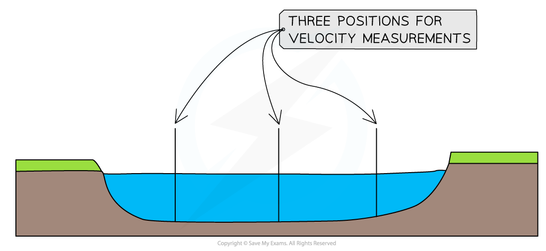
    • 25+ meter tape to measure the river width and for marking out distance downstream for velocity measurements
    • 1-metre rule for measuring the depth
    • Clipboard for holding recording sheets
    • Pencil for writing in data
    • Camera to take photographs of sites and river features
    • Float or flowmeter for measuring velocity
    • Stopwatch if not using a flowmeter

Worked example

Identify a suitable piece of equipment to measure river velocity (1)

  A   Anemometer
  B   Quadrat
  C   Clinometer
  D   Stopwatch

  • Answer:
    • D (1) - Stopwatch which is used to time how long it takes a float to cover a specified distance

Risk Assessment

  • Any fieldwork will involve consideration of health and safety using a risk assessment
  • Risks associated specifically with river fieldwork may include:
    • Weather conditions
    • Slippery rocks
    • Polluted water
    • Working in an unfamiliar place
    • Misuse of equipment

Worked example

A group of students has investigated the changes in a river channel shape.

State one risk that the students might identify in their risk assessment (1)

  • Answer: Any one of the following would be acceptable
    • Slip or fall (1)
    • Infection from dirty water (1)
    • Flash flooding (1)
    • Weather conditions (heavy rain/sun) (1)

Suggest one way the risk stated could be managed (1)

  • Answer: This should follow from the answer above
    • Sturdy/suitable footwear e.g. walking boots (1)
    • Wash hands/use antibacterial hand wash/cover cuts and wounds (1)
    • Do not enter the river after heavy rainfall (1)
    • Check the weather forecast before going out to collect fieldwork data (1)

Using Equipment in the Field

Data Collection Methods

  • The data collection methods will depend on the aims/hypothesis of the fieldwork
  • The starting point with most river fieldwork is to measure the width and depth
  • Data collection should include both quantitative and qualitative methods
  • The collection of quantitative data can be completed in several ways in a river study

Width

  • The measurement of width is taken where the water surface comes into contact with the river banks.

width-measurementsMeasurement of River Width

  • To take an accurate measurement:
    • Measure from the point where the dry bank meets the water on one side to the point where the dry bank meets the water on the opposite side
    • Ensure that the tape is held taut and does not touch the water this could affect the reliability of the data

Depth

  • The measurement of depth should be completed at regular intervals across the width
  • This ensures a full picture of the changes in depth across the whole channel width are recorded
  • It also allows a mean depth to be calculated to use in the calculation of river discharge

depth-measurementsDepth Measurements 

  • To take an accurate depth measurement:
    • Work out the distance apart each depth measurement needs to be 
    • Place a meter rule into the water at the correct point
    • Ensure the meter rule is placed sideways on with the flat side facing the banks - this reduces any impact on the water height ensuring more accurate measurements 
    • Record the distance from the bed to the surface of the water
    • Repeat this across the width of the river

Velocity

  • The velocity is the speed at which the river flows
  • This can vary across the channel width as well as along the course of the river so velocity should be recorded in three positions - towards the left bank, centre and towards the right bank

velocity-measurements

Positions in River Channel for Velocity Measurements

  • Using a flow meter velocity can be easily measured by:
    • Taking readings at three equal distances across the river width 
    • Placing the flow meter into the water at least 3cm below the surface
    • Three readings should be taken at each of the three places across the channel to allow the calculation of a mean
  • To take an accurate measurement using a float:
    • Measure a set distance upstream - for example, 10 meters
    • Drop a float at the start of the 10 meters
    • Time how long it takes for the float to travel the distance using a stopwatch
    • Repeat at each position three times to allow the calculation of a mean

Discharge

  • The discharge of the river is calculated rather than measured
  • The first step is to calculate the cross-sectional area: 
    • Cross-sectional area (m2) = width (m) x mean depth (m)
  • The second step is to calculate the velocity:
    • If a flow meter the mean velocity should be calculated by adding the velocity measurements and dividing by the number of measurements
    • If a float has been used and a distance of 10m then the meantime should be divided by 10 to calculate the time taken to travel 1m
    • Discharge (m3/s) = cross-sectional area (m2) x velocity (m/s)

Worked example

Calculating Discharge 

Step One - Depth 

  • Calculate the mean depth
  • All units of measurement should be the same
  • The mean depth should be calculated in meters not centimetres 

Depth measurements for Site One

  1 2 3 4 5 6 7 8 Mean
Depth in m 0.05 0.12 0.17 0.23 0.30 0.35 0.28 0.18 0.21

  • To calculate the mean depth add the 8 measurements together and divide by 8 
  • This gives a measurement of mean depth = 0.21m

Step Two - Cross-sectional area

  • Cross-sectional area (m2) = width (m) x mean depth (m)
  • If the width is 4m x mean depth 0.21m the cross-sectional area = 0.84m2

Step Three - Velocity

Time Measurements for Site One

Time measurement Left  Centre Right
1st 35 28 37
2nd 42 30 39
3rd 36 27 45
Mean 37.7 28.3 40.3

  • To work out the mean time taken for the float to travel 10 metres for site one the following calculations need to be completed:
    • 37.7 + 28.3 + 40.3 = 106.3
    • 106.3 is then divided by 3 (number of positions) to give a mean time for site one of 35.43 seconds
    • Divide this by 10 to get the velocity in m/s 
    • 35.43/10 = 3.543 seconds
    • The surface velocity for site one is 3.543 m/s

Step Four - Discharge

  • Discharge = Cross-sectional Area 0.84mx Velocity 3.543 m/s
  • Discharge = 2.98 m3/s (cumecs)

Photographs and Field Sketches

  • Photographs and field sketches are qualitative data 
  • Just as with any data collection and presentation they have strengths and weaknesses
  • In a river enquiry photographs and field sketches can be used to show landforms and particular features such as bed load
  • Photographs are also ideal for illustrating the data collection methods used

Worked example

During a geographical enquiry exploring changes in a river, channel students completed annotated field sketches as part of their data collection.

Suggest two advantages of this technique (4)

  • Answer:
    •  Students can get a quick view of the areas they are working recording key features (1) to support recall later (1)
    • Students can highlight features (1) that they want to focus on as part of their study (1)

Exam Tip

Annotations and labels are not the same. A label is a simple descriptive point. For example, 'meander'. Whereas an annotation is a label with a more detailed description or an explanatory point. For example, 'slip off slope where the material has been deposited due to slower flow'

You've read 0 of your 0 free revision notes

Get unlimited access

to absolutely everything:

  • Downloadable PDFs
  • Unlimited Revision Notes
  • Topic Questions
  • Past Papers
  • Model Answers
  • Videos (Maths and Science)

Join the 100,000+ Students that ❤️ Save My Exams

the (exam) results speak for themselves:

Did this page help you?

Bridgette

Author: Bridgette

After graduating with a degree in Geography, Bridgette completed a PGCE over 25 years ago. She later gained an MA Learning, Technology and Education from the University of Nottingham focussing on online learning. At a time when the study of geography has never been more important, Bridgette is passionate about creating content which supports students in achieving their potential in geography and builds their confidence.